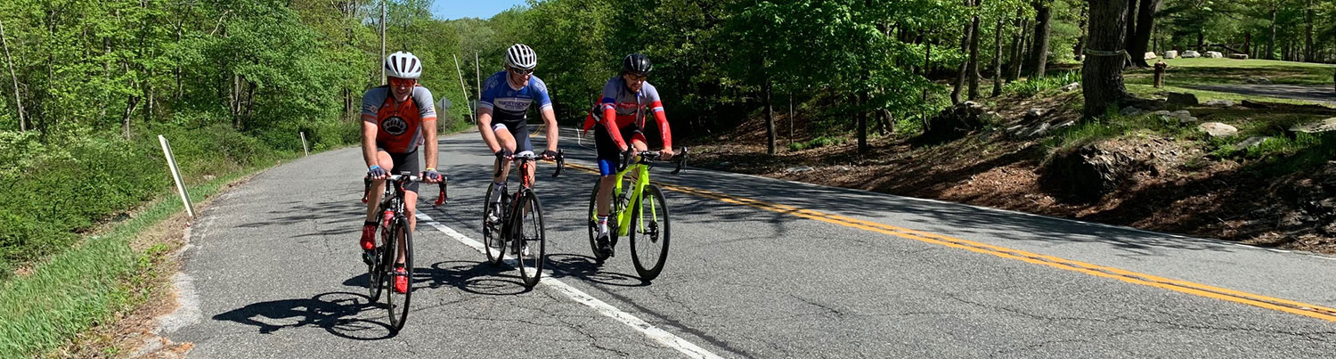
Ride #2
Beemerville-Libertyville Loop
Distance: 11.7 miles Elevation Gain: 862 feet
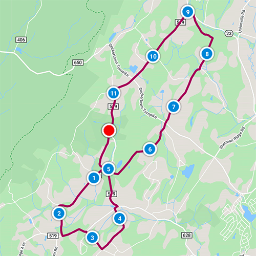
Ride Notes
Farmland, orchards, a real milestone, hamlets of Libertyville and Beemerville, and a volcano!
Directions
This ride starts at the Lusscroft Farm Gatehouse on Rt 519, 3 miles from Rt. 23, just before Rutgers Rd. Do not block the gate.
0.0
From the stone gatehouse at the entrance to Lusscroft Farm, turn right onto Rt 519.
0.06
Bear right onto Rutgers Rd.
0.7
Turn right onto Lusscroft Rd.
0.9
As of this writing, the Jacob Ayers house is still standing. Hopefully, it will be here as you’re reading this. It may be just legend, but according to Our Wantage Heritage, Judge Enoch Ayers held court here and the attic was used as a gallows where hangings took place. Look for the 1814 “Date Block” and religious inscription in the exterior stone work.
1.0
Pass DeGroat Rd on your right.
Notice the Fruit/Root Cellar built into the hillside. Think about how important it would have been to store a winter’s worth of food before electricity and supermarkets.
Carefully cross the road to look over the guardrail. Why is there a tiny structure built in the swampy area here? Springhouses were common before electricity to keep milk cool before it was trucked to the nearest creamery.
1.4
Beemerville Orchards
Outstanding apples, peaches, and cider! Return at ride’s end to take home some of nature’s bounty.
1.8
Pass Card Rd on your right.
There are a number of Card families in the area.
2.3
The old Wantage/Beemerville Grange Building on your left.
The Grange was a farmers’ association that sponsored social activities, community service, and political lobbying.
2.4
Turn left onto Rt 519.
For a short side trip, turn right to immediately enter the Beemerville section of Wantage. The cemetery on your right is worth a quick ride-through. The Beemerville Presbyterian church is on your left, followed by Space Farms Zoo and Museum, a good stop if you have the time. In addition to the animals, the Space family has lots of antiques and historical artifacts in their collection. More than a few people have passed on oral information that the wheels of the caisson that carried Lincoln’s and Kennedy’s bodies were made in the Plumbsock/Beemerville area of Wantage. I’ve heard that they came from a wheelwright’s shop in Plumbsock; Fred Space, whose family has lived here for generations, believed they were built in the carriage shop in Beemerville. I’ve never been able to locate documentation. Return to the corner of Lusscroft and Rt 519 to continue the ride from Milepost 2.4.
2.5
Pass Beemerville Auto Wrecking.
2.8
Turn right onto Decker Rd.
Pass Beemerville Country Store entrance on left.
3.3
Turn left onto Holland Rd.
Wantage Township has a sizable population of Dutch-Americans, hence the road name.
4.2
Turn right onto Rt 519.
4.3
Hamlet of Plumbsock
Turn left to stay on Rt 519 (Rt 628 continues straight.)
Rt 519 is New Jersey’s longest county route. Extending almost 90 miles from somewhere in the bowels of Central Jersey, it extends north through Wantage Township and terminates at the New York border. It’s a favorite of motorcycle day-trippers since it twists, turns, curves, and roller-coasters through some of the best countryside New Jersey has to offer.
5.0
Turn right onto Coykendall Rd.
Like many of our township’s roads, this one is named after an early white settler.
6.5
Deckertown Tpk Intersection
Take a very short (about 200 ft) side trip by turning left and looking on your right for a “milestone” that resembles a gravestone. Most people today use the term milestone for an important marker in one’s life. Well, now you know where the term originates. You are 54 miles from Jersey City, according to this milestone.
Return to intersection and continue mileage from Milepost 6.5.
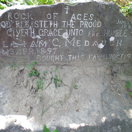
Cross intersection. The road name changes from Coykendall to Hickory. In approximately 300 ft on your right is a hand-laid rock foundation for a natural spring that’s been filled in with sediment from the nearby cornfield. Look for the “Rock of Ages” inscription that’s chiseled into the rock. The inscription on this rock embodies the strong work ethic and deep religious conviction of our early farmer settlers.
7.1
Cross Tennessee Pipeline.
7.7
Turn left onto Ramsey Rd.
8.5
Turn left onto Rt. 23
It’s safer to stay on the wide southbound shoulder from here to the corner.
8.9
Turn left onto Rt. 519
9.9
Cross Snover Rd.
10.5
Re-cross Deckertown Tpk.
Deckertown Turnpike was once part of a stagecoach route from Jersey City to Milford, PA.
11.0
Volcano Hill
The steep hill on your right is all that remains of the only volcanic site in New Jersey. The “Beemerville Volcano” was active 440 million years ago. The hill is privately owned, but can be viewed by hiking the Lusscroft Farm Loop, now part of High Point State Park. The trailhead is approximately 1 mile from here on Neilsen Rd.
11.7
Return to Lusscroft Farm Gatehouse.
To visit the Lusscroft Farm Compound, extend your ride by biking uphill about a half mile past the gatehouse on the road that’s called “4-H Trail.”
Lusscroft Farm was first a model dairy farm, then an agricultural research center, then a 4-H outdoor education center.
Be sure to check out the Lusscroft Farm Facebook page.