Ride #9
Library Loop
Distance: 12.3 miles Elevation Gain: 1006 feet
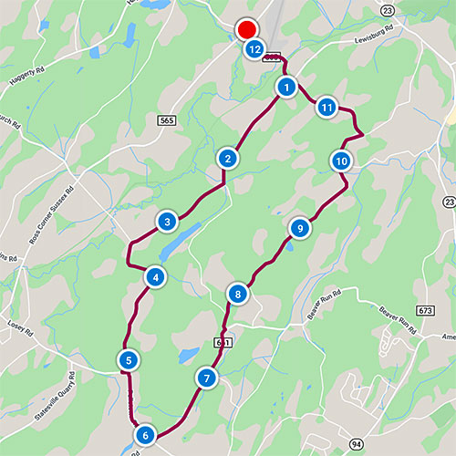
Ride Notes
Working and abandoned farms, bucolic vistas, interesting rock outcroppings
Directions
This ride starts at the Sussex-Wantage Public Library, approximately one mile from Sussex at the intersection of Routes 565 and 639 (Loomis Ave). The first mile of this ride is on a winding road with minimal shoulder and regular traffic. To eliminate this section (from the library to Lewisburg Rd) you can park along Lewisburg Rd or at the snow plow turnaround at the Wantage Twp line (but not from Nov 1—April 30).
0.0
Turn left out of the Sussex-Wantage Library.
The unused sidewalk leads to the corner. Use it.
0.7
Cross Papakating Creek and pass Lehigh & New England abandoned railroad.
The Papakating Creek flows north where it joins the Wallkill River. “Papakating” is derived from the language spoken by the Munsee, the northern branch of the Lenni Lenape. Arrowheads, net sinkers, and other artifacts have been found along this creek that provided the Native Americans with abundant food.
0.9
Turn right onto Lewisburg Rd.
2.3
Bear right to stay on Lewisburg Rd. (Some maps show the road on left as Lewisburg Rd.)
The Sussex Ski Tow that operated from 1947 into the 1950’s was located at this intersection. A 1,250-foot rope tow was run by a Ford Model A engine at the top of the hill. A warming hut that served food was located at the bottom. A ski ticket cost $2.00. For more information, refer to Skiing in New Jersey by Elizabeth Holste.
As of this writing, a portion of the road ahead is unpaved and rough. Watch for loose stones and potholes.
3.5
Pass Roy Rd on right.
Continue straight onto Spreen Rd.
4.0
Wantage/Lafayette Town Line
If you pull into the snow plow/school bus turnaround, you’ll see where Spreen Road once continued as a dirt road. In the 1990s, it was open and used as an illegal tire dump. More than a thousand tires were dumped off the side of the road.
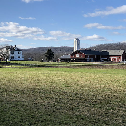
4.6
Windmill in Farmyard
Windmills were a common sight before electricity came to the area in the 1930s. Wind power was used to pump water into the barns for cows.
5.2
Turn left onto Pelletown Rd.
6.1
Turn left onto Beaver Run Rd.
7.5
Turn left onto Pond School Rd.
10.4
Turn left onto Compton Rd.
11.1
Wantage House
This grand residence was built on the foundation of a home dating back to the 1700s. According to Our Wantage Heritage, a still was operated here during Prohibition but exploded and burned the home to the ground. From 1981—1992 this was a satellite campus of Upsala College. The land and buildings were donated by a local philanthropist, Wally Wirths.
11.5
Lewisburg Rd Intersection—continue straight.
12.3
Return to Sussex-Wantage Library.
Our Branch Library has tons (literally!) of books, magazines, CD’s, DVD’s, research material and more. There’s always an interesting collection in the display case. Check out the library’s website and the Friends of the Sussex-Wantage Library Facebook page for on-going events. While here, inquire about the Historic Wantage Township Map produced by one of our most beloved citizens, Barbara Young. The map is a treasure trove of Wantage History.