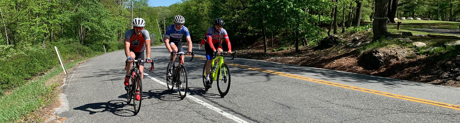
Ride #5
Owen Station / Oil City Circuit
Distance: 14.5 miles Elevation Gain: 882 feet
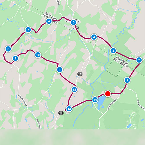
Ride Notes
A wildlife refuge, the Wallkill River, Oil City, popular birding site, hills, views, and a “Bigfoot” sighting area.
Directions
This ride starts at the Owens Station Friends of the Wallkill River Refuge parking lot in Vernon, less than a mile from the Wantage border. From Rt 284, take Bassetts Bridge Rd. After crossing the Wallkill River, bear left. The road here is Owens Station Rd. A large sign on the right indicates the parking area next to a large pond.
0.0
From the Owens Station parking lot of the Wallkill River National Refuge, turn right.
The wetlands on either side of the road were once part of a glacial lake, left behind when the glaciers retreated and melted 10—15 thousand years ago. The wooden structure visible (when leaves are down) ahead and to the right is a residence, but was once a Vernon schoolhouse.
0.5
Turn left onto Lake Wallkill Rd.
0.8
Pass Glenwood Mt Rd on your right.
1.5
Enter Orange County, NY.
Lake Wallkill Rd changes to Liberty Corners Rd in NY.
1.9
Turn left onto Oil City Rd.
(If you’d like to see what a “Sears Home” looks like, continue straight instead of turning. The 3rd house on the left is a Sears Home. From 1908—1940, Sears, Roebuck and Co. sold complete home kits that could be shipped by railroad, delivered to site by truck and constructed.)
Continue from previous (1.9) milepost.
2.4
Pass abandoned railbed.
2.6
Pass Wallkill River National Refuge Liberty Loop trailhead and observation platform, a favorite year-round spot for birders.
The wetlands on either side of the road are the same you passed at the very beginning of the ride. Early immigrant settlers called this area “The Drowned Lands” and immediately began digging trenches and small canals to drain the land. The area is now known as “The Black Dirt Region” and, just a few miles north, is well-known as a major producing area of onions.
3.1
Parking lot for Winding Rivers trailhead.
The Winding Rivers Trail is a flat, easy, 2-mile walking loop that winds its way next to the river where there are some small, scenic rapids.
3.2
Cross over the Wallkill River.
The Wallkill River is unusual in that it flows north between the Delaware and Hudson Rivers, both of which flow south. The river begins at Lake Mohawk in Sparta, NJ and flows into the Rondout Creek and empties into the Hudson at Kingston, NY. The river serves as the eastern boundary of Wantage Township.
You are now riding on the Appalachian Trail. For a short distance, the AT uses this roadway.
3.3
Pass Carnegie Rd on your left.
Take a short trip down this road to see what’s left of “Oil City.” Oil City was created in 1906 as a major way station on a pipeline that transported oil from Pennsylvania to Bayonne, NJ. For more information, find Jenny Sweetman’s article in the NJ Herald’s issue of June 26, 2016, available at the Sussex-Wantage Library.
As you climb this rise, look back for a pleasant view of the Pochuck Mountains of Vernon. To the north of them are Mt Adam and Mt Eve, two hills that stand out from the flat, black dirt area of Pine Island, NY.
3.7
Cross Lower Rd.
The road’s name changes here to State Line Rd. From the time you turned onto Oil City Rd, you’ve been paralleling the state line, in some places so close you could almost throw a stone from New York to New Jersey.
4.5
Turn right onto Rt 284.
Minimum shoulder in some spots. Be aware.
4.9
Pass Unionville Firehouse.
Check out the fire gong!
5.0
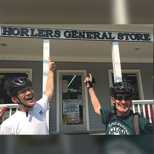
Cautiously, bear left onto Main St.
A tavern, general store, and pizzeria are available in town.
5.14
Pass Railroad Ave.
If you look carefully at the side of the road, you can see tracks that come out where they were buried under the roadway.
5.2
Pass First Presbyterian Church of Unionville.
Pretty belfry and stained glass
5.3
Bear left to stay on NY County Route 36.
5.6
Pass Quarry Rd on left.
5.8
Welcome Back to New Jersey!
Road here is Unionville Rd (County Rt 651).
5.9
Cross Appalachian Trail.
6.0
Pass Mt Salem Rd on right.
6.6
Very sharp, sweeping, downhill curve.
7.0
Pass Rockport Rd on right.
7.1
Swamp
Birders like this spot.
8.0
Wolfpit Farm
This residence was converted from the one-room Wolfpit Schoolhouse.
8.3
Ride straight onto Wolfpit Rd.
(Unionville Rd continues down the hill on your right.)
8.7
Bear left to stay on Wolfpit Rd.
9.7
Pass Black Dirt Rd on your left.
10.1
Pass Quarry Rd.
10.2
Look into the woods on your left for the standing chimney and a well, all that’s left of an old homesite.
On the way down this hill, keep an eye out for a Sasquatch!
10.5
Bigfoot Sighting
There once stood an old farmhouse on the left and a dairy barn on the right. The residents of the farmhouse claimed that a 7-ft tall creature covered with hair, with a beard and mustache, and walking on its hind feet tore into their barn and mutilated their rabbits. The family waited for this visitor the next night, positioning themselves in the farmyard and armed with shotguns and rifles. When they saw his two red eyes they “opened up,” firing more than 30 rounds. For the whole story, visit the microfilm library at the Sussex-Wantage Library and look up the May 10 and May 17, 1977 issues of the NJ Herald.
10.7
Turn right onto Lott Rd.
10.9
Turn left onto Havens Rd.
11.8
Turn right onto Dunvale Rd.
12.0
Merge onto Rt 284.
12.8
Carefully, turn left onto Bassetts Bridge Rd.
13.8
Cross Wallkill River; re-enter Vernon Township.
13.9
Stay straight onto Owens Station Rd.
14.5
Return to Owens Station Parking Lot.
The Friends of the Wallkill River National Wildlife Refuge work hard maintaining the annual wildflower gardens here. Stop and browse. Check their Facebook page for beautiful nature pictures that are posted frequently. Check their activities schedule—there is always something interesting going on.