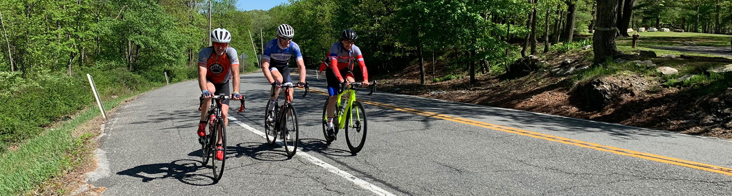
Ride #11
High Point Ridge Road Ramble
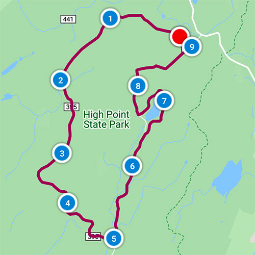
Distance: 9.3 miles Elevation Gain: 498 feet
Ride Notes
Okay, okay, the title of this guide isn’t accurate. I lied! This ride and the next are not in Wantage Township; they’re in Montague! But I’ve included them for a few reasons. First of all, they’re practically in Wantage. The farthest distance from the Wantage border of either ride is less than two miles. And no matter where you are in Wantage, the Kitattinny Mountain Range and High Point Monument are always in sight. Part of High Point State Park is within Wantage, and the people here have a strong connection to the park. A possible 2.2 mile extension is suggested at milepost 5.0.
The feeling of these two rides is very different from the others. There are no homes, barns, or farms. The rides utilize roads built by the CCC and are completely within the park’s boundary.
Directions
This ride starts at the HPSP Park Ridge Rd Winter Parking Lot. From Rt 23, turn left onto Sawmill Rd, then right onto Ridge. The parking lot is on your left.
0.0
From the Park Ridge Rd Winter Parking Lot, turn left onto Park Ridge Rd.
Pass the Group Camping Cabin on left and Group Campsites on right.
0.2
“The woods are lovely, dark, and deep.”
You are entering a deciduous woodland forest, typical of the Northeast. You won’t find any “old ones” here. Most of the trees are less than a hundred years old. From the mid-1800s through the early part of the 20th century, this entire area was logged for timber and charcoal.
0.6
Pass Steenykill Rd on right.
Steenykill Rd is closed here and is just an old wagon road. It’s a pleasant .6 mile hike to the point where it’s open and paved. It then descends steeply the whole way (approx. 2 miles) to Clove Rd in Montague.
1.6
Mashipacong Rd /Mashipacong Trail
If you hike into Mashipacong Trail on your left about a half-mile, you can find (if you’re a good observer) the remains of a homesite. Look for rock walls and an aged lilac, sure signs of an old farmstead. The best time to search for the caved-in foundation is winter, when foliage is dead.
2.5
Ayers Trail
This is another old farm road that leads to open fields where, long ago, the Ayers family farmed. Combining Mashipacong & Ayers Trail and Ridge & Sawmill Roads makes an easy and enjoyable hiking/snowshoeing/skiing trek. A hiking trail map is available in the Park Office on Rt 23. The best hiking trail maps are published by the NY--NJ Trail Conference. Their cartographer grew up in Wantage and graduated from our public schools. You can read his bio and buy maps @ New York-New Jersey Trail Conference | The Authority for NY-NJ Hiking Trails (nynjtc.org)
3.4
Tennessee Gas Pipeline
This is part of an 11,900 mile set of natural gas pipelines extending from the Texas-Louisiana Gulf Coast to New England.
5.0
Turn left onto Sawmill Rd.
(To extend the ride 2.2 miles, turn right, bike to the end of Sawmill Road at Red Barn Pond, return to this point.)
5.1
Re-cross gas pipeline.
6.4
Turn right onto the one-way Sawmill Campsite Road.
(If you want to shorten the ride by almost a mile, continue straight on Sawmill Rd.)
During the spring—fall camping season, bathroom facilities and water are available at three locations.
The roads, hiking trails and even this lake were constructed by the Civilian Conservation Corps (CCC). From 1933—1941, about 2,000 young men worked here under the supervision of the National Park Service and the US Army. For a comprehensive study of the CCC at High Point, read We Can Take it! The Roosevelt Tree Army at New Jersey: High Point State Park by Peter Osborne, available for checkout at the Sussex County Library.
7.6
Turn right onto Sawmill Rd.
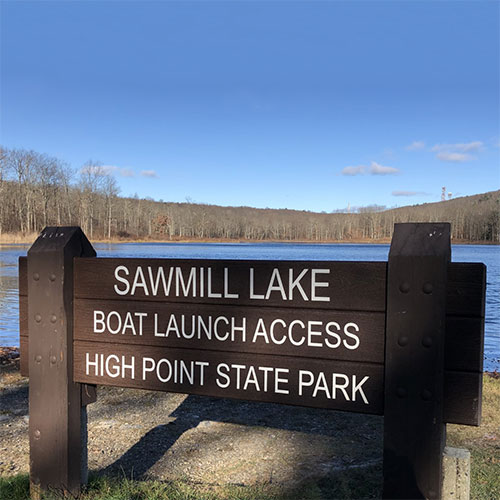
(For a beautiful view of the lake and High Point Monument, turn left and ride about .2 mi. to the boat launch and dam. Return and continue from previous milepost.)
7.8
Pass Ayers Trail on left.
8.2
Pass Mashipacong Trail.
9.1
Turn left onto Park Ridge Rd, unless:
If you’re adding the HPSP Monument Extension Loop to this ride, follow directions for extension.
9.3
Arrive back at the Winter Parking Lot.