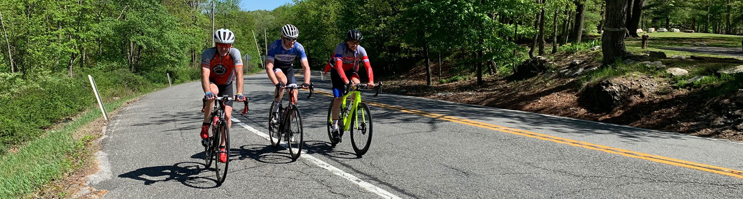
Ride #7
Minisink Turnpike Trek
Distance: 17.0 miles Elevation Gain: 1445 feet
Ride Notes
Woods, fields, swamps, an historic stone house, Appalachian Trail Crossings
Directions
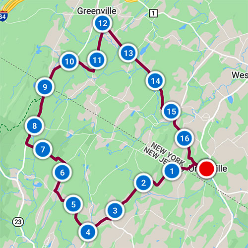
This ride starts in the little town of Unionville NY, barely over the Wantage Twp border. It’s a convenient place to park a car. Unionville is 7.5 miles from Sussex via Rt 284. Start at the small town park across from the pizzeria, next to the Unionville Village Office.
0.0
From the pocket-sized town park turn left onto Main St.
0.3
Bear left onto Orange County Rt 36.
0.6
Pass Quarry Rd on left.
Bear right. State line is just ahead where the road name changes to Unionville Rd (Sussex County Rt 651).
0.7
Appalachian Trail Crossing
There are no grand announcements for the trail crossing. If you’re not looking for it, you’ll miss it.
0.9
Pass Mt Salem Rd on right.
1.5
Very sharp right-hand curve
2.0
Swamp
Good birding spot
2.8
Wolfpit Farm
This residence was once the Wolfpit One-Room Schoolhouse.
3.2
Bear right to continue on Unionville Rd.
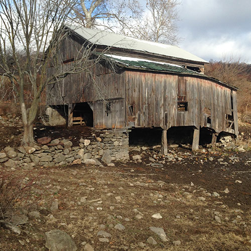
3.5
Restored Barn
Some folks who bought Wantage farms tore down the barns. The Wantage resident who bought farmland on the left decided to save this barn. Thank you!
3.8
Bear left to stay on Unionville Rd (Rt 651).
(Clove Rd begins on right.)
4.0
Turn right onto Skytop Rd.
Get in your lowest gear!
4.7
“Skytop” farmstead on right.
5.0
Harvey Mead Stone House, circa 1840
5.5
Turn right onto Mudtown Rd.
6.2
Turn left onto Glen Rd.
7.5
Turn right onto Greenville Rd (Rt 519).
8.0
Pass Mt Salem Rd on right.
8.7
Re-cross Appalachian Trail.
9.1
NJ/NY State Line
The New Jersey/New York border was once a source of conflict. In the early 1700s a series of skirmishes, raids, and crop burnings known as the New York-New Jersey Line War occurred between residents of both states. It wasn’t until 1772 that a permanent line was established. Seems to me a crazy idea, risking your life to fight over whether to pay taxes to New Jersey or New York!
The road name changes to Mountain Rd (Rt 55).
10.1
Turn right onto Hardscrabble Rd.
10.7
Turn left onto Case Rd.
12.0
Turn right onto Minisink Tpk.
12.5
Cross wetlands.
13.1
Cross Logtown Rd.
Look for the historical marker designating this area as Center Point.
15.0
Pass Goodridge Rd on right
15.1
Pass Ridge Rd on left.
Look for the historical marker designating this area as Waterloo Mills.
15.2
Road name changes to Pine Hill Rd.
15.6
Ford Rd.
For a short (approx. 1.5 mi out-and–back) side trip to see a beautiful quilt showing the history of the Minisink area, turn left. At the end of Ford Rd, turn right and stop into the Minisink Municipal Office where the quilt hangs.
16.5
Cemetery
Look for the very small unmarked cemetery in the back field on your right. Most of the headstones are unnamed.
16.7
Continue onto Main St.
16.9
First Presbyterian Church of Unionville & Our Lady of the Scapular
Stop to admire these churches with beautiful belfries.
17.0
Arrive at start.