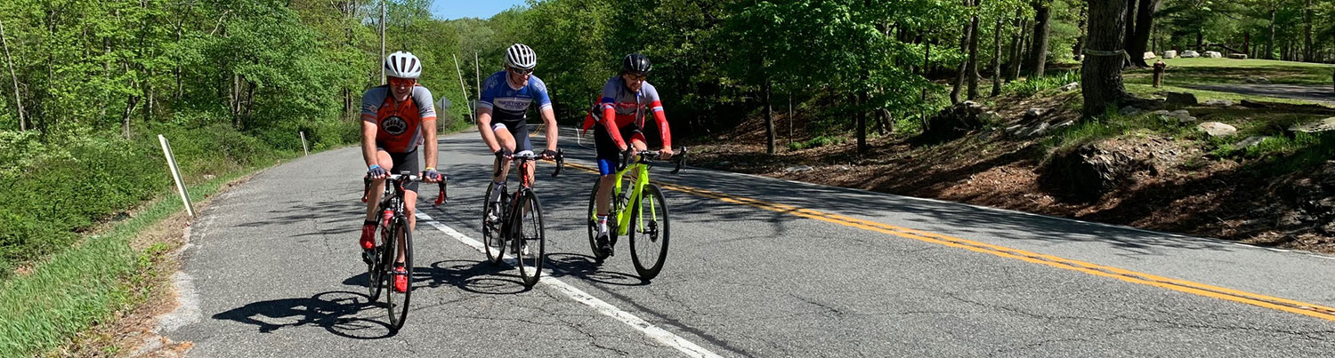
Ride #8
Woodbourne Whirl
Distance: 11.8 miles Elevation Gain: 882 feet
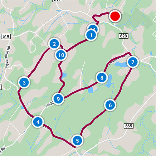
Ride Notes
This is the perfect ride to see the transition Wantage has made from an agricultural area to a residential community. You’ll see some silos and barns, and if you peer into the woods you’ll find crumbling rock walls. You’ll see a few farms that are now home to horses, not dairy cows. But what you’ll really notice are all the new homes that sit on what was, just a short time ago, farmland.
Directions
The ride starts at Woodbourne Park, located on Sherman Ridge Rd.
0.0
From the park entrance, turn left onto Sherman Ridge Rd.
0.5
Turn right onto Berry Rd.
According to Fred Space, this section of Wantage was referred to, years ago, as “Death Valley” due to the murder of Amzi Berry at his farmhouse. If you’re interested in murder, mystery, and love triangles, check out the microfilmed NJ Herald article of June 21, 1934 at the Sussex-Wantage Library.
0.5
Turn left onto County 628.
0.7
Turn right onto Dyer Rd.
Pass Vandergoot Rd on left.
1.9
Turn left onto Holland Rd.
Many of our residents are immigrants or descendants of immigrants from the Netherlands. The name of this road is tribute to their origin. I once met a woman from Bergen County who told me she comes to Wantage Township once a year to buy Speculaas at the Holland American Bakery. If you don’t know what Speculaas are, then get to the bakery on Rt 23 and find out!
2.1
Pass Decker Rd.
3.2
Turn left onto Beemer Church Rd.
There is a minimal shoulder here, but traffic is light.
Beemer Rd, Beemer Church Rd, Beemer Hill Rd, and the hamlet of Beemerville are all named for the Beemers, early white settlers.
3.8
Pass Haggerty Rd.
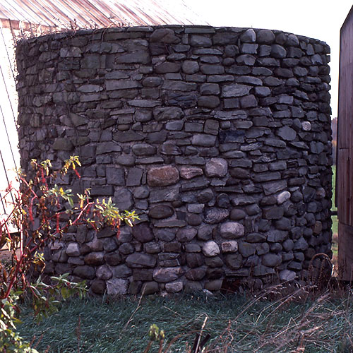
4.1
Stone Silo
Examine the remains of an early silo. Imagine the work and time it took to collect the local stones, then lay them up into this circular structure.
4.9
Turn left onto Pidgeon Hill Rd.
Yes, that’s the way it’s spelled. Perhaps it’s named after someone, but my guess is that someone misspelled pigeon.
6.4
Look carefully into the woods to see the remains of a farm structure made from locally-gathered stones.
6.7
High Point Regional High School<.
Eighth grade graduates from Sussex, Wantage, Frankford, Lafayette, and Branchville all meet as freshmen Wildcats at HPRHS.
If you look past the pond on your left you will see High Point Monument on the Kittatinny Ridge.
7.1
If you look over the guardrail on your right, you’ll see a tributary of the Papakating Creek. The water follows a course that drops a few hundred feet between here and McCoys Corner near the Sussex-Wantage Library. The energy from this creek’s water was once used to generate electricity for Sussex.
7.2
Turn left onto Haggerty Rd.
Haggerty is another local family name.
9.0
Turn right onto Decker Rd.
There are lots of Deckers in the area. Peter Decker was the first white settler in what is now Sussex, but was once Deckertown.
10.0
Turn right onto Vandergoot Rd.
10.1
Turn right onto Dyer Rd.
You will be retracing the beginning of the ride.
11.1
Turn left onto County Rt 628.
11.3
Turn right onto Berry Rd.
11.8
Turn left onto Sherman Ridge Rd.
11.83
Entrance to Woodbourne Park.
Woodbourne is our municipal park. Besides a playground, athletic fields, and a veterans memorial, there is a pleasant, paved walking loop that’s approximately 1.5 miles.